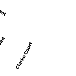
12 CLARKE CT
Owner Information
CAREW, ELIZABETH
12 CLARKE CT
SHARON, MA 02067


Property Details
12 CLARKE CT is classified as a Single Family Residential (Conventional).
The primary structure on this property was built in 1900. There are 3,090ft2 of built area within this property. There is 1,472ft2 of residential/living space within this property.
12 CLARKE CT is valued at $363,600. The land is valued at $236,800 and the structures are valued at $124,600. There is an additional valuation of $2,200 on this property.
The most recent deed for 12 CLARKE CT is recorded at the local registrar in Book 37739, Page 66. 12 CLARKE CT was last sold on Thursday, April 2, 2020 for $420,000.
Assessment data from fiscal year 2022.
Flood Data
According to the FEMA National Flood Hazard Layer, this property does not appear to be in a flood zone. It may also be in an area not yet reviewed. Nonetheless, confirm this information prior to taking any action.
To view the flood hazards around this property, create a FEMA "Firmette" Map of the area around 12 CLARKE CT.
Broadband Internet Providers
| Provider | Type | Bandwidth (mbps) | |
|---|---|---|---|
| HughesNet | Satellite | 25 | 3 |
| Viasat Inc | Satellite | 100 | 3 |
| Verizon New England Inc. | DSL | 5 | 0 |
| Comcast | Cable | 1000 | 35 |
| T-Mobile | Fixed Wireless | 25 | 3 |
| GCI Communication Corp. | Satellite | 0 | 0 |
| VSAT Systems, LLC. | Satellite | 2 | 1 |
Broadband service provider data from December 2020.
Adjacent Properties
- 5 GARDEN CT
Condominium NL MDL-05 owned by SILVA, JESSICA A. - 7 GARDEN CT
Condominium NL MDL-05 owned by WAMBUA, DANIEL - 5 GARDEN CT
Other, Open Space owned by KENT, JOSEPH X TR - 000 RR R/W #19
Vacant, Transportation Authority owned by MASS BAY TRANS AUTH - 000 RR R/W #17
Vacant, Transportation Authority owned by MASS BAY TRANS AUTH - 14 CLARKE CT
Single Family Residential owned by MARQUES, CARLOS